digital. stories. by Patrick Brown
  • Home
  • About
    • About Me
    • About digital. stories.
    • My Books
  • Blog
    • Adventure
    • Aerial Photography
    • Antarctica 2012
    • Grand Canyon 2014
    • Kayaking
    • New Years
    • Road Trip 2013
    • Technology
  • Photos
  • Videos
  • Maps and GPS
  • Projects
    • Van
      • Van For Sale
    • House
    • Technology
    • LASP
Search the site...
  • Home
  • GPS

GPS

Proximity Waypoints in the Grand Canyon

March 22, 2014 / Pat Brown / GPS, Grand Canyon, Technology

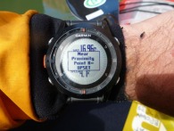
It should come as no surprise that navigating the Grand Canyon is a serious undertaking even in today’s GPS age. So before I embarked on a self-support kayak trip down the Colorado River in the Grand Canyon, I made sure I was prepared with the most up to date, accurate navigational data and tools. My […]

Read More

Garmin, gps, Grand Canyon

Google Earth Network Links

January 23, 2010 / Pat Brown / GPS, Technology

Download my Google Earth network link, open it in Google Earth, and then save it to My Places in G.E. The next time you open Google Earth, my network links will automatically appear in the left pane under places and will have all the latest KMZ files that I have added!

Read More

digital, mapping, web

Embedded Google Earth

May 21, 2009 / Pat Brown / GPS, Technology

Edit 5/21/2009: The G.E. plugin is killing performance on my PC and since it wasn’t too impressive, I have removed it from this post. It is now incredibly easy to embed Google Earth into a blog or website, with the results that you see (maybe) below. However, I’m not sure how effective of a tool […]

Read More

digital, mapping, web

Geotagging Photos using RoboGeo

April 24, 2009 / Pat Brown / GPS, Technology

Geotagging is basically the process of associating location with photographs and can be accomplished in many ways. I have developed a process using a commercial product called RoboGEO that not only geotags the photos, but also creates KMZ files that allow the photos and associated GPS data to be viewed in Google Earth. Here is […]

Read More

digital, gps, mapping, photos, web

Creating a GPX Trip File

April 23, 2009 / Pat Brown / GPS, Technology

Here is a nice procedure I have developed for concatenating several days worth of GPS waypoints and tracks into a single GPX file. The end result is a compact, neat file that hierarchically contains each day’s track and waypoints with appropriate descriptions. This file can be easily shared and viewed intuitively in most mapping programs, […]

Read More

digital, gps, mapping

GPS Data Recording for a Multi-Day Trip

April 23, 2009 / Pat Brown / GPS, Technology

After some trial and error, I have a nice method of recording GPS data on multi-day trips that is useful both during and after the trip. I typically use this procedure on backpacking, biking, and rafting trips when I will be sequentially moving from one location to another. In these case, I like to know […]

Read More

gps, mapping

SPOT Satellite Messenger

May 2, 2008 / Pat Brown / GPS, Technology

Another GPS based device I recently acquired (also thanks to my REI refund) is the SPOT Satellite Messenger. It is generally considered a sort of personal locator beacon (PLB), but those who know better quickly point out that it is based on completely different technology, so it is really in a category of its own. […]

Read More

digital, gps, SPOT, web

Garmin Forerunner 305 GPS for Running

May 2, 2008 / Pat Brown / GPS, Technology

I recently purchased a Garmin Forerunner 305 GPS to complement my running training with Fastforward Sports. I’m training for the Bolder Boulder 10K and the Rocky Mountain 1/2 Marathon and thought this gadget would be just what the doctor ordered. It is feature-packed, GPS-enabled wrist-top computer that is designed to assist in training for running, […]

Read More

digital, gps
Copyright 2013 Patrick Brown