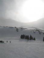
The weekend began with yet another April blizzard along the Front Range, but ended with warm, sunny weather in the Utah desert! I began Friday (4/17/09) by battling awful road conditions through Clear Creek Canyon and up I-70 and was treated to lack of heat in the van during the blizzard as my thermostat decided […]
Archive: April, 2009
Geotagging Photos using RoboGeo
Geotagging is basically the process of associating location with photographs and can be accomplished in many ways. I have developed a process using a commercial product called RoboGEO that not only geotags the photos, but also creates KMZ files that allow the photos and associated GPS data to be viewed in Google Earth. Here is […]
digital, gps, mapping, photos, webDigital Workflow
Why "digital. stories."?
If you have wondered why my blog is titled, “digital. stories. by Patrick Brown“, this stream of consciousness may provide some answers. Digital data may be used as a means of telling stories. Dumping a bunch of photos on the web tells a story about as well as dumping of bunch of random words on […]
digital, ramblings, webCreating a GPX Trip File
Here is a nice procedure I have developed for concatenating several days worth of GPS waypoints and tracks into a single GPX file. The end result is a compact, neat file that hierarchically contains each day’s track and waypoints with appropriate descriptions. This file can be easily shared and viewed intuitively in most mapping programs, […]
digital, gps, mappingGPS Data Recording for a Multi-Day Trip
After some trial and error, I have a nice method of recording GPS data on multi-day trips that is useful both during and after the trip. I typically use this procedure on backpacking, biking, and rafting trips when I will be sequentially moving from one location to another. In these case, I like to know […]
gps, mappingColorado River Follow-Along
I am heading out to raft the Colorado River through Ruby/Horsethief/Westwater canyons at the Colorado/Utah border this weekend, and I found a cool, free website that will allow me to embed a map with my current location into my blog. It is called SPOT Trip Manager, and it seems to be a free service that […]
gps, mapping, outdoorsShoshone and Hanging Lake
My kayaking season had to begin somewhere with flowing white water, and the class III Shoshone run on the Colorado River seemed like a nice way to ease back into the cold April water. Plus, it seemed fitting that the van’s first long voyage away from Loveland Pass should take it Glenwood Springs just like […]
kayak, outdoors, storiesDid you hit it with a hammer?
When the day was over, I had been asked this by at least four separate individuals. And to think that I had never heard of this trick before this week. Unfortunately it didn’t help, and I needed a bigger metaphorical hammer to get my van moving in the snow again. The spring snow storms have […]
outdoors, stories, van, Westfalia